
Page 269 - 360.revista de Alta Velocidad - Nº 6
P. 269
Study of Transit-Oriented Development model implementation on the surroundings of Alicante
high-speed rail station
On the other hand, the model is centred on the route, on the pedestrians moving around the Connect: to create dense street and route networks. This principle got 11 points out of 15
streets, and it forgets the ones standing there. The model does not make any reference to urban possible. In this case, 2 points were dropped because of the excessive length of some blocks,
furniture, benches, squares or any other places where people could meet just for having a good making waking less attractive. The other 2 points were dropped because of the predominant
time. position of the road network.
Overall, TOD standard model is a complete and effective work tool. It provides quantitative Transit: to foster development around high-quality transport. This principle is accomplished as
measures from objective parameters. These parameters are easy to be measured and indicate the area of activity has been delimited to the station surroundings. This principle is thought to
the situation of the studied area in relation to essential indicators of urban mobility. be applied to the development of new cities or areas.
5. Conclusions and suggested actions to be taken in the studied area. Mix: to design a plan for mixing uses. This principle got 5 points out of 15. The alarming result
is due to the lack of diversity on the land use. There is a clear predominance of residential use.
The conclusions obtained from the results of the study are: The only positive aspect is that every building has easy access to fresh food (within less than
500 meters). We cannot either find affordable housing in the area, thus excluding low income
Walk: to develop neighbourhoods that promote walking. This principle has 11 points out of 15, people from living there and marginalising them to the city outskirts.
it seems a good score. Getting into detail, the 3 points lost have in common that the car has
a predominant position in the street as opposite to pedestrians. It is clear that the pedestrian Densify: to optimise transport capacity and density. This principle has the maximum score with
network is insufficient. In short, nowadays the area around the station enhances the use of cars 15 points. The reason is that the station surrounding is one of the densest area in the city.
instead of walking. The other point lost concerns visually active frontage, that is, the quantity Compact: to create compact areas with short distance access. This principle got 15 points out
of shop and building windows on the front, providing security to the pedestrians. of 15. This can be explained by the fact that the station is located in the city centre and can
be considered as the most important commercial area in decades. Therefore, it is almost fully
urbanised and there is a good public transport service with many lines.
Shift: to enhance mobility by regulating roadway use and parking. This principle got only 6
points out of 20, the worst result. It once more highlights that the area around the station is far
too focused on parking areas and use of motor vehicles.
5.1 Suggested short-term actions
To pedestrianize and to complete the pedestrian network: ideally, pedestrian routes would be
created in the area but this must be done in a progressive way.
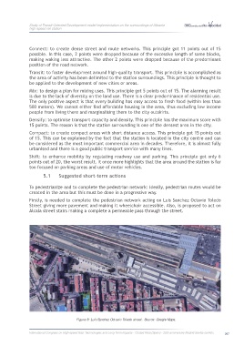
Firstly, is needed to complete the pedestrian network acting on Luis Sanchez Octavio Toledo
Street giving more pavement and making it wheelchair accessible. Also, is proposed to act on
Figure 5: Frontage of the high-speed rail station. Source: own photo.
Alcala street stairs making a complete a permeable pass through the street.
Cycle: to give priority to non-motorised transport networks. This principle has 2 points out of 5.
The reason is that there is no cycle path. The majority of cycle routes are in the roadways and
share space with motor vehicles limited to 50 km/h, thus becoming non-secured spaces. The
reason is the same as in the previous point, the own car has a predominant position. The 2
points obtained come from the existence of the cycle parkings, but they are mainly outdoors,
including those in the high-speed rail station.
Figure 6 and 7: Cycle spaces in Plaza Seneca in the surroundings of the high-speed rail station. Source: own photos.
Figure 8: Luis Sanchez Octavio Toledo street. Source: Google Maps.
International Congress on High-speed Rail: Technologies and Long Term Impacts - Ciudad Real (Spain) - 25th anniversary Madrid-Sevilla corridor 267